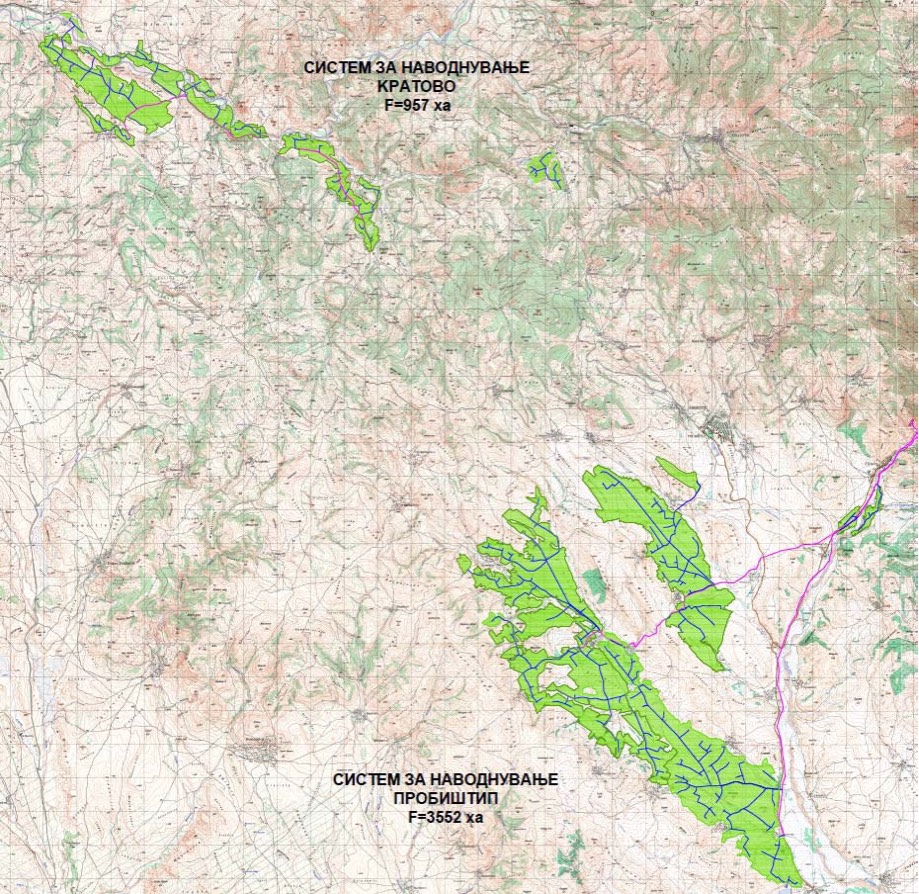
The irrigation system Kratovo covers 957 acres of agricultural land with the construction of three reservoirs: Markovica, Sakulica and Povishnitsa, as well as an intake structure “Gorno Gradiste” on the Anska River for addition to the accumulation Sakulica. According to the configuration of the terrain for the irrigation system Kratovo, several alternative solutions have been worked out and the solution was chosen as the most suitable where the irrigation system is divided into three subsystems:
- Subsystem Markovica with an area of 354ha
- Sakulica subsystem with an area of 535ha
- Subsystem Higher area 68ha
Basic characteristics of the Markovica subsystem
The Markov subsystem covers 354 ha of arable agricultural area and consists of: dam and accumulation Markovci, water supply pipeline and irrigation network.
The dam Markovci is projected on the river “Vrilej Dol” near Kratovo. River “Vrilej Dol” is a left tributary of the Povishnica River, which flows from the Osogovo Mountains and has a variable flow throughout the year. The dam is of projected height of H = 34.5 m with a crown of 496.5 m. and forms an accumulation with a volume of V = 754.633 m³.
The irrigation surfaces extend from a minimum elevation of 322 m above sea level up to a maximum elevation of 473 m above sea level.
The total length of the irrigation network of the Markovica subsystem is L = 16.670 m.
Basic characteristics of the Sakulica subsystem
The Sakulica irrigation subsystem covers a 535 ha arable agricultural area and consists of: Dam and accumulation Sakulica, water supply pipeline and irrigation network. To supplement the accumulation Sakulica, construction of an intentional construction of the Gorno Gradishte (Tyrolean grip) is predicted in order to utilize the favorable catchment area of Anska Reka – a catchment area of 7.9 km².
The Sakulica dam is planned to be performed on the river. “Bela Voda”, which is left tributary River Povosnitsa and flows from the southwest part of the mountain Osogovo in the area called Sakulica. The height of the dam is predicted at a height of Н = 30.0 m with an elevation of the crown on the 497.5.00 meters above the sea which will form an accumulation with a useful volume of V = 764.000 m³. Within the dam all necessary facilities are predicted for the period during the construction and facilities for normal operation during the exploitation.
The areas for irrigation extend from a minimum elevation of 420 m above sea level up to a maximum elevation of 546.5 m. The total length of the irrigation network of the Sakulica subsystem is L = 23.527 m.
Basic features of the Subsystem Povishnica
Irrigation subsystem Povishnica covers 68ha arable agricultural area and consists of an intake Povishnica and an irrigation network.
In order to complement the catchment area of Povishnica, it is predicted to construct a discharge construction vicinity of the Zguri, on the existing pipeline for water supply.
The surface extends from a minimum elevation of 538 m above sea level up to a maximum elevation of 674 m. The total length of the irrigation network of the Subsystem Subsystem is L = 4.174 m.